
The Development
Information for Longueville and surrounding communities on the development specifics and local impact.
The NSW Government uses the district planning process to define objectives and set goals for job creation, housing supply and choice in each district. Lane Cove has been grouped with Hornsby, Hunters Hill, Kuring-gai, Mosman, North Sydney, Ryde, Northern Beaches and Willoughby to form the North District. The Greater Sydney Commission has released the North District Plan which includes priorities and actions for Northern District for the next 20 years.
The North District Plan identifies the “projected growth in people aged 65+ in the North District means that there must be more emphasis on planning for housing diversity particularly seniors housing and aged care options that allow people to age in place.”
Australia’s and specifically Sydney's ageing population will increase demand for aged care services, particularly high care facilities. It is expected that the needs of older Australians will become more diverse in terms of their care requirements. This trend will require aged care providers to be flexible and responsive to the changing needs of the elderly. This development is able to directly support the changing needs of the Sydney population by providing 143 residential aged care beds in a high demand and under supplied area of Sydney.
The development will directly contribute to this priority by providing aged care dwellings near the St Leonards Health and Education Precinct and both the Royal North Shore and Mater Hospitals. It will allow local residents the option of remaining in the immediate locality as they progress into their senior years. It also provides housing options within close accessible distance to community facilities, such as shops, churches, medical centres, and the like.
The Development Location.
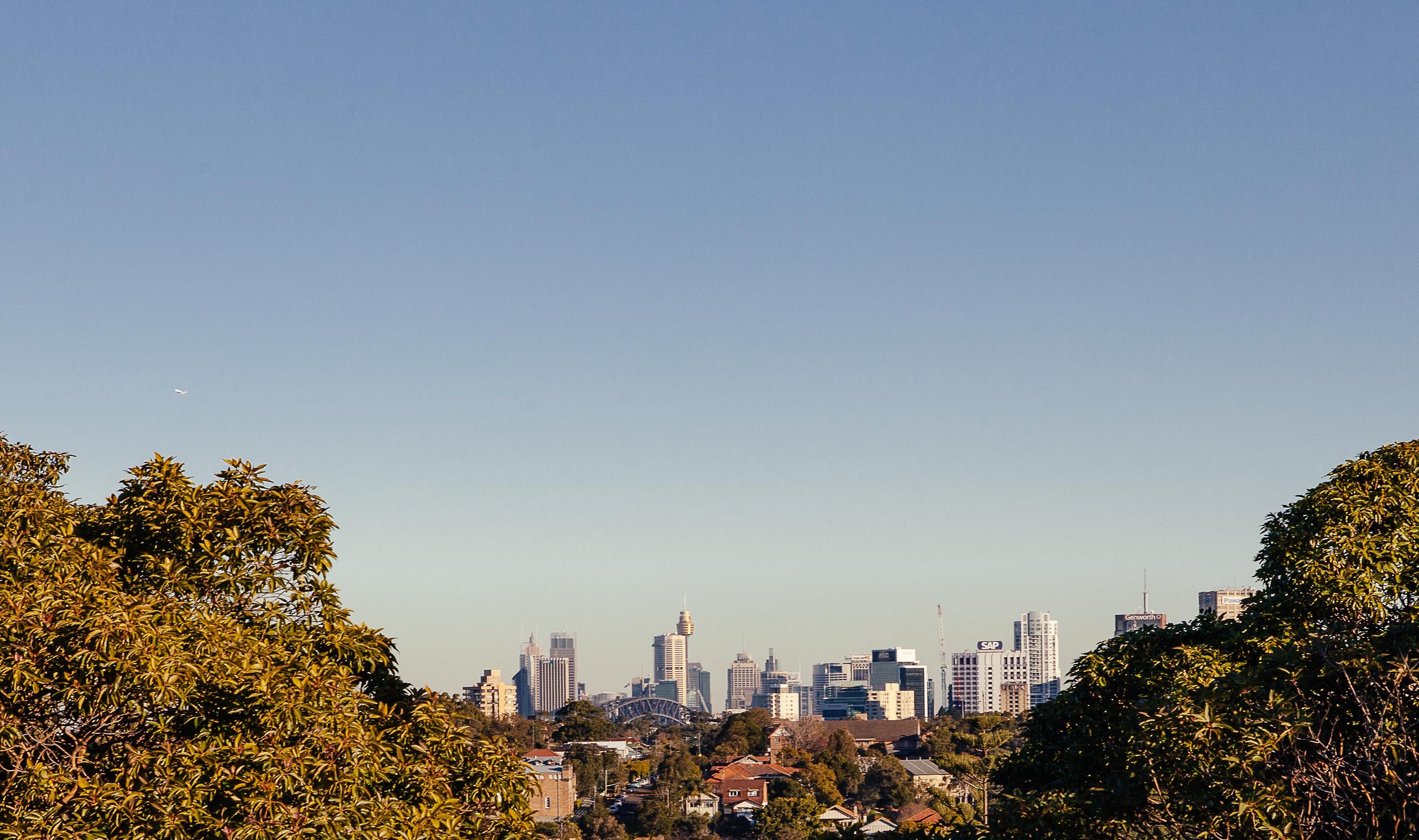
The site is located at 4-18 Northwood Road and 274 - 274A Longueville Road, Lane Cove, and is situated approximately 9km north-west of Sydney Central Business District (CBD). The site is within the Lane Cove Local Government Area (LGA) and is approximately 2km from St Leonards Railway Station and 1km south of the Lane Cove Town Centre and bus interchange.
The development is situated within the precinct known as the 'Northwood Neighbourhood Centre'.
The mixed use building includes a Residential Aged Care Facility (RACF) and 2,051sqm commercial premises and medical centre including ancillary hydrotherapy pool.
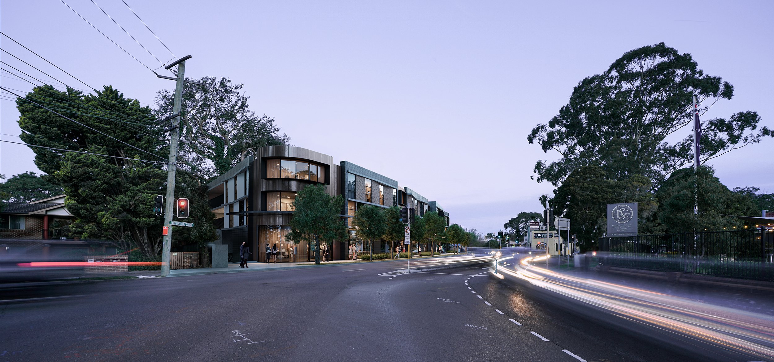
The development presents to Northwood Road as a 3 storey building then cascades down the slope of the site to the rear. Terraced levels take advantage of the easterly views over the adjoining bushland and golf course. Street front activation will be provided though the ground floor commercial tenancies and multiple view corridors provide glimpses to the bushland from the public domain.
The site has a total area of 5,003 m² and a street frontage of 104m to Northwood Road.
Environmental Impact
Consideration of the relationship between the site and the adjoining bushland was a fundamental element of the site specific project planning process. In response to consultation with Council and state agencies the development has adopted a 10m rear setback from the bushland.
All proposed works are located within the site boundaries and will not adversely impact on the adjoining bushland. The proposed plant species have been carefully selected to complement the adjoining bushland and an Arboricultural Impact Statement was prepared to ensure there are no adverse impacts on the trees located within the bushland. The most significant areas of bushland located within Gore Creek to the east will be retained ensuring the natural heritage of the area is maintained.
The subject site is within the Sydney Harbour Catchment. Therefore, the Sydney Harbour Catchment Sydney Regional Environmental Planning Policy (SREP) applies to the development.
The development is a substantial distance from the nearest water body and its foreshore. It has been designed in accordance with typical stormwater capture, filtration, and release measures to ensure its stormwater generation does not unreasonably affect the health of the Sydney Harbour or its foreshores. The site's substantial distance from any water body ensures it is not visible from Sydney Harbour or any related catchments.

Aerial view with site marking (pre-development).

Close-up aerial view of site prior to development.
Mixed Zone Objectives.
The development is consistent with the Lane Cove Local Environmental Plan (LCLEP) objectives in that:
The mixed-use development will contain a RACF and will contain compatible future uses on the ground floor such as a pharmacy, veterinary clinic, café and restaurant for not only the onsite residents but also the wider community.
The development is in an accessible location, approximately 1km south of Lane Cove Town Centre and a bus stop is located directly at the front of the site. This will encourage people to utilise the local bus services and walk and cycle to nearby centres.
During the design development, consideration has been given to the proposed public domain at Northwood Road and creating an attractive and activated pathway outside the site. The development seeks to extend the existing footpath and include new paving and street trees.
The design of the proposed building ensures that adjoining properties achieve a minimum of 3 hours sunlight in mid-winter and that sufficient solar access is provided to the Northwood/Longueville Road frontage.

3D Aerial view, south-west (Source: MDPA)

Development Statistics
FSR = Floor Space Ratio, GFA = Gross Floor Area, RACF = Residential Aged Care Facility
The development (including the height variation) does not result in any detrimental impacts on the adjoining or nearby properties in terms of overshadowing, privacy, or view loss. The development has been designed with consideration of the existing buildings on adjoining sites as well as their potential future redevelopment. Appropriate setbacks are provided to the adjoining residential developments including a 6m setback to the northern boundary and 2.5m (lower ground levels) and 11.5m-18m (upper levels) setbacks to the southern boundary.
Traffic and Parking Impact
The development plans detail the provision of 86 car parking spaces, with 51 for commercial use, 15 for aged care residential use and 20 for residential aged care staff use, satisfying the requirements of Council’s DCP and the Seniors State Environmental Planning Policy (SEPP). The plans detail a loading area, which is suitable for ambulance use as detailed in Section 3.4 of the Traffic and Parking Impact Assessment (TPIA) prepared by McLaren Traffic.
The likely traffic generation of the facility and the ability of the local road network to accommodate any change in traffic quantity was thoroughly analysed as part of the project planning process. The traffic impact assessment (TIA) undertaken by McLaren Traffic assessed the specific mix of land uses. The TIA concludes there will be little perceptible change due to the low traffic generation created by a RACF and the relatively limited quantity of commercial land uses.
The TPIA concludes that the level of net change in traffic is relatively minor and is not expected to noticeably impact the existing conditions of the surrounding road network. Further, there will be no detrimental or noticeable impact to the performance of the intersections surrounding the site.
3D Concept Art of Pathways Longueville
Developed by Morrison Design Group


Contact us
If you would like more information on the development process, applying for residential aged care at Pathways Longueville or on Pathways Residences, please contact us by clicking the button below or via our top menu.